Mount Mitchell is located in North Carolina in the Black Mountain range. It is known as the highest peak east of the Mississippi at 6,683 feet. To get to a mountain higher than Mount Mitchell, one would have to head way out West. This is what attracted me to make the hike. I’ve hiked in the Rockies. They’re majestic and beautiful. But, who wouldn’t want the experience and bragging rights of bagging Mount Mitchell? Especially since such a natural wonder is literally in my own backyard?
The Trailhead.
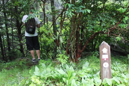
I hiked the Mountains To Sea Trail to the summit of Mitchell. Here are directions for finding the point of entry. Wherever you are, take the Blue Ridge Parkway and head toward Mile Marker 355.4. Depending on which way you come, you’ll see NC 128 and a sign directing you to Mount Mitchell State Park. Turn here. There is no official parking lot at this particular trailhead, but here are a couple of markers: Shortly after turning onto NC 128, look on the left side of the road for an almost hidden set of wooden stairs coming down to the roadside. This is the Mountains to Sea Trail. On the right side of the road across from the stairs is a small gravel pull-off. There is a post marking the entry point to the portion of the Mountains To Sea Trail that leads to the summit of Mount Mitchell. Park here, have someone let you out, whatever. (If there is no parking, you’ll have to drive further up the road, park at the Mitchell Visitors Center, then walk back down.)
At the post is a set of steps leading down to the trail. Take these and when you get to what is clearly a graveled trail, turn left and stay left.
The Hike.
The trail I hiked was the longest to the summit of Mitchell. I took the Mountains To Sea route up as I mentioned (around 6 miles) and the Old Mitchell Trail back down. From the trailhead back to the trailhead is about 12 miles round trip.
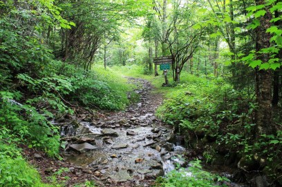
On the day we hiked, which was in June, the sky was overcast. The air was humid and foggy, and recent rains had caused several run-offs to wash across the trail. I’ve heard very few people say they summited Mitchell under clear skies. Any time you’re hiking in the Black Mountains, you can expect to get rained on, often out of the blue. Bring proper rain gear!
The trail itself was in good condition, though wet. We didn’t have very good views, sometimes none at all due to dense low-hanging fog, but as you can see from the pictures below, it was still a beautiful hike. The trail gradually ascends a few miles until you get to the Commissary Trail, to which you’ll turn left and follow the signs.
Eventually you’ll come to the boreal forest about a mile from the summit. I can’t describe how magical this place is. It’s Tolkien-like. You’ll turn right into the treeline, following the white blazes and the clearly marked signs. The trail also begins to ascend steeply here. Very steeply. You’ll climb over mossy and slick boulders, downed trees, exposed roots, ditches, and rocks on your way to the summit.
Then, suddenly, you’ll exit the trail (again following the signs carefully) and now you’ve come to the tourist section of Mount Mitchell. Honestly, it’s an underwhelming experience. There’s a paved road at which you’ll turn and follow to the right. This leads to the summit. The summit has a large lookout tower, often crowded. You will also see the iconic sign saying you’ve made it to the top, as well as Elisha Mitchell’s tomb. On the day we summited, there was a large gathering of people honoring fallen civil servants on the lookout tower’s summit. We hiked up and partook of the service. It was nice.
After lunch, and some rest, we walked back down the paved road and re-entered the place where we came out of the forest. From here we followed the Old Mitchell Trail (follow the signs and blazes which will direct you to the right). This trail was very rugged and challenging. It was more of an across trail than a downward sloping trail. We passed a couple of very nice balds and through several balsam groves. Eventually you’ll come to a restaurant. Go through the parking lot and pick up the trail at the edge of the forest on the other side of the restaurant. After a nice walk of a mile or two, you’ll come to a graveled portion and then the Visitors Center.
From here we walked down the side of the highway back to our car.
Mission accomplished.


Reblogged this on Waterfalls Hiker and commented:
Here is an interesting way to the summit of Mount Mitchell! I have been planning to hike the trail that begins in the Black Mountains Campground….this route though, starts on NC 128 which is the hey that takes you to the top of Mount Mitchell from the BRP!!
LikeLike
Great post and awesome shots! Hope to hike there someday!
LikeLike
Thanks! Please do, you’ll never regret it.
LikeLike
Amazing photos! It looks magical. I’ve added this hike on to my bucket list. I live in upstate SC but only recently started hiking in NC.
LikeLiked by 1 person
Thank you! I’ve had a lot of interest in doing a group hike. It was a beautiful hike!
LikeLike