 I’ve always wanted to hike in the Green River Gamelands in Saluda, North Carolina. I finally had the opportunity to do so this past weekend with my friend Josh. We only hiked a portion of the trails (there are 9 “official” ones), mainly to get a feel of what the terrain is like. I’ve heard the Gamelands trails were rugged in places, and they certainly were! The trails form a sort of loop that is around 10.5 miles in length, with a total of 16 miles of trails throughout the Gamelands. We decided to take the higher ground and hike the Bluff Trail, Turkey Gut Trail, and Stair Step Falls Trail. I’ve got no idea how many miles we logged, probably around 5, as our entire route took about 4 hours round trip.
The trailhead.
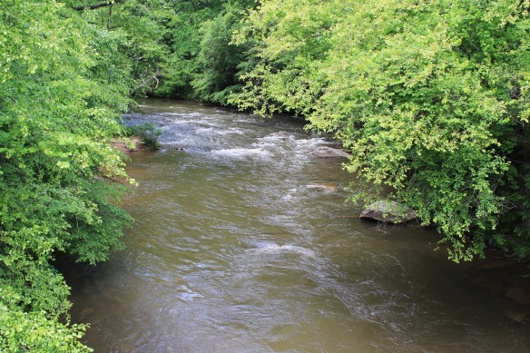
Take I-26 to Exit 59. If you’re coming from South Carolina, the exit will be on the right. Take a right at the stop sign onto Holbert Cove Road. Drive a short distance and there is a sign for the Gamelands on the left. Turn here and follow the descending road into the gorge. Drive safely as there are a number of hairpin turns. After reaching the bottom, continue on Green River Cove Road crossing the bridge over the Green River. Parking is on the right. It’s simply a small gravel pull-off (additional parking is across the bridge in a larger parking area).
The Green River Cove trailhead is across the road from the parking area to the left of a residential driveway. We missed it the first time because weeds had grown up over the trail sign. Also, we got our map online, and from a book by Danny Bernstein. Interestingly, several of the maps diverged from one another slightly. So be aware of that. 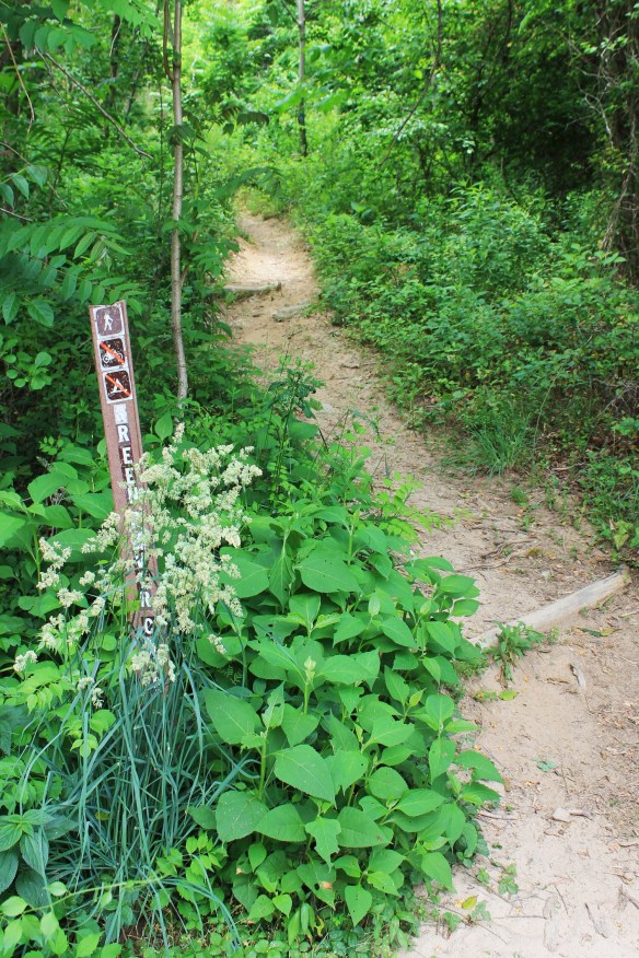 The hike.
We decided to take the higher trails hoping to catch some good views of the gorge and river below. We began on the Green River Cove Trail. The first thing you notice is a set of stair steps. The trail ascends up with views of the Green River below on the left. After a short distance, there is an obvious offshoot trail and marker for the Bluff Trail on the right. The Bluff Trail is a very strenuous, narrow, and rocky 1 mile hike up a mountain side. The elevation gain here is 700 feet over one mile! There are a few places where the steepness might even make scrambling necessary for some. 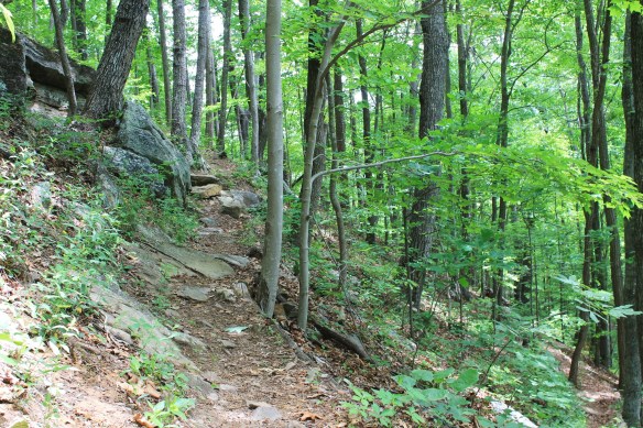 The end of Bluff Trail is the intersection with the Turkey Gut Trail. The Turkey Gut Trail goes either right or left. We initially wanted to take a right to look out over Pace Cliffs, but the trail was overgrown.
 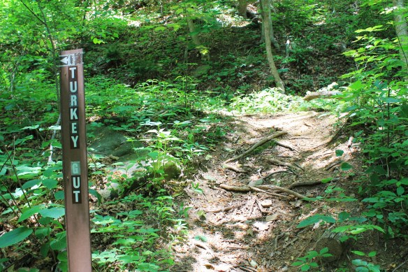 This would be a nice trail to revisit in the winter. So, we turned around and head left toward the Stair Step Falls Trail. Turkey Gut Trail is about 3 miles in length. As it ascends, there are overlooks on the left and rocky outcroppings above the trail on the right. After a while you’ll hear then see Stair Step Creek on the left. Be careful here because there are several sheer drop-offs. You’ll see Stair Step Falls Trail on the left. The trail crosses over the creek here. We continued on around Turkey Gut for about ¼ of a mile into a clearing. We had a snack here and then turned back and crossed onto Stair Step Falls Trail.
The Stair Step Falls Trail is a moderate-to-strenuous 1.5 mile long connector (It connects with the Long Ridge Trail). As soon as you pass over the creek, the falls will be below you on the left. The only way to get to the falls is to sit and slide down a steep ravine. Or use a rope. The falls themselves were nothing to get excited about, at least they weren’t with our legs burning from the climb we‘d just made! I didn’t take pictures. The falls are basically three or four narrow, small cascades that aren’t easy to view. Perhaps after a good rain they’d have been more enticing to climb down and view. 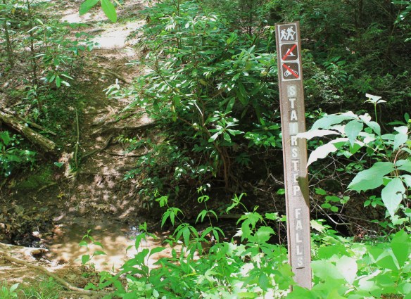 We continued on the trail. To the left is Loobie Cliffs. The trail winds in and out of coves and crosses a couple of small streams. At the last of these streams is a very short but steep climb up and around to a fairly level area filled with blooming mountain laurel. We stopped here on the ridge, rested, ate another snack, then retraced our steps back to the trail head.
 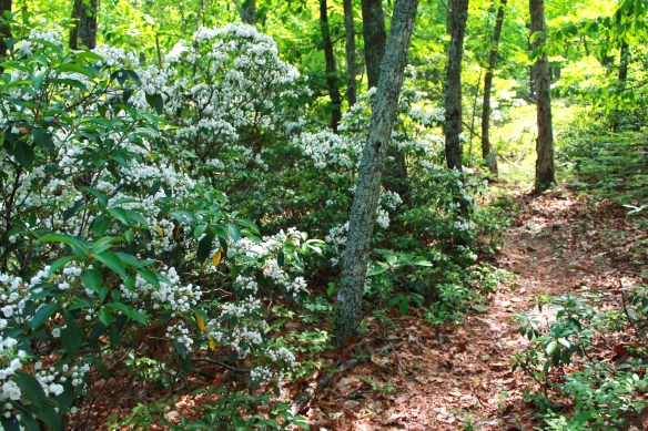 This would be a much more scenic hike in the winter or fall, as the higher elevation views are obscured by foliage. This is also not a “pay off” type of hike, meaning there’s no exciting destination until you descend back down along the Green River. Stair Steps Falls would be nice if it were fuller. This was simply a rugged hike for hiking’s sake. I enjoyed the challenge and the scenery and the solitude. Next time the plan is to continue on the Green River Cove Trail and go view the famous Narrows. Again, the route we took was steep, rocky, and strenuous. After we finished we drove and stopped at a little roadside fruit stand across the interstate. The owner informed Josh that the route we took had been known to see significant rattlesnake activity. Thankfully, we missed those!
I’ll blog part 2 when we make it.
See you on the trail!


