
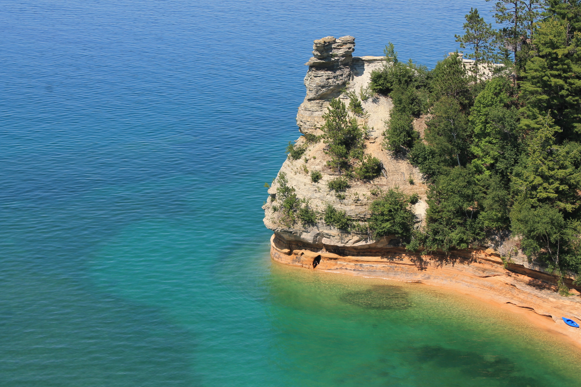
My family and I took our annual vacation in late July. We’d long wanted to see the Pictured Rocks National Lakeshore in Munising, Michigan, which is located along the shores of Lake Superior. The multi-colored cliffs were a thing to behold, as well as the multi-hued refractions in the water from which they rose. Here’s a pic:
 I’ll include a few more pics in the gallery at the end of this post.
As expected, The Upper Peninsula is home to some nice hiking trails. We had the kids with us, so we knew we’d have to stay on more family-friendly trails. Family-friendly does not have to equal boring, as you’ll soon see.
I’m not going to include my usual detailed “finding the trailhead” information, but I will include links to help you find each trail’s location along with more information.
We lodged in picturesque Marquette, Michigan. The drive to Munising was about 45 minutes, but it was a very scenic drive, so we drove it daily.
Miners Falls
The first trail we hit was Miners Falls. It was a 1.5 mile round-trip trail located off the road to the more popular Miners Castle trail (Miners Castle is pictured above). A unique feature is the trail includes 77 steps down to a falls viewing area.
The trail was relatively level, and the breeze off Lake Superior made it a relaxing walk. The 50 ft. waterfall was a good payoff on this for-the-whole-family trail.


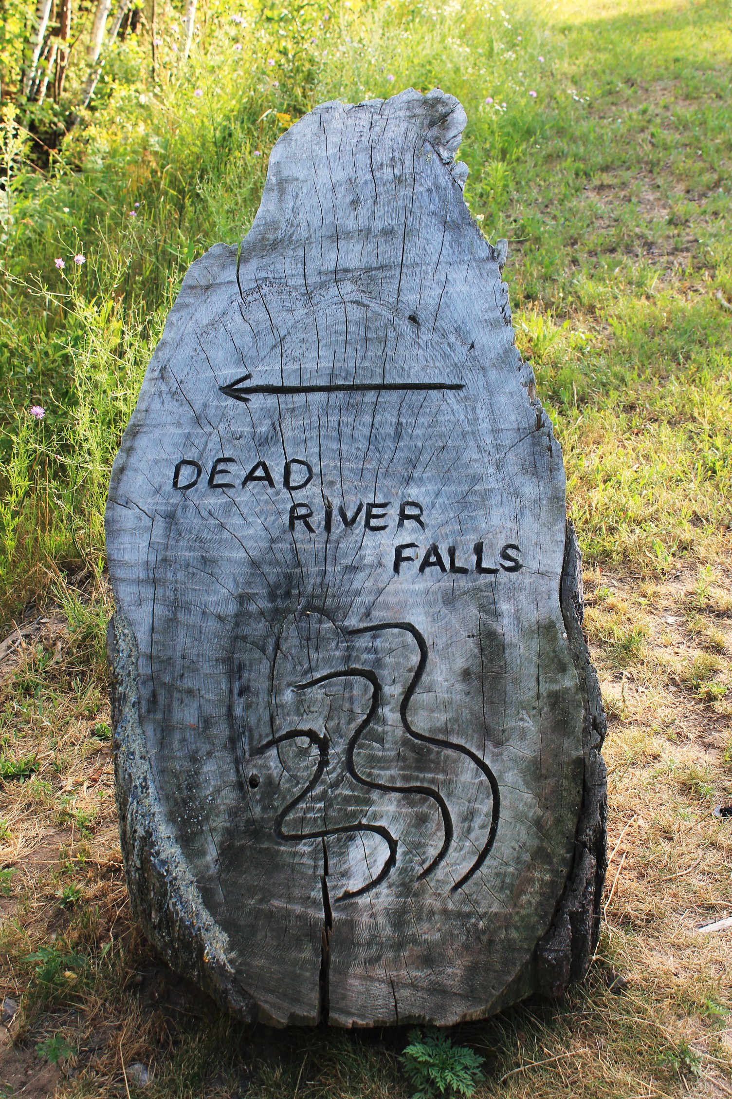
Dead River Falls Trail
This trail is located back in Marquette. It wasn’t mentioned on any of the literature we had, we ran across it on the internet searching for hiking trails closer to where we were staying.
The falls themselves are located off an unpaved county road. Here are directions to the trailhead (plus some good pictures).
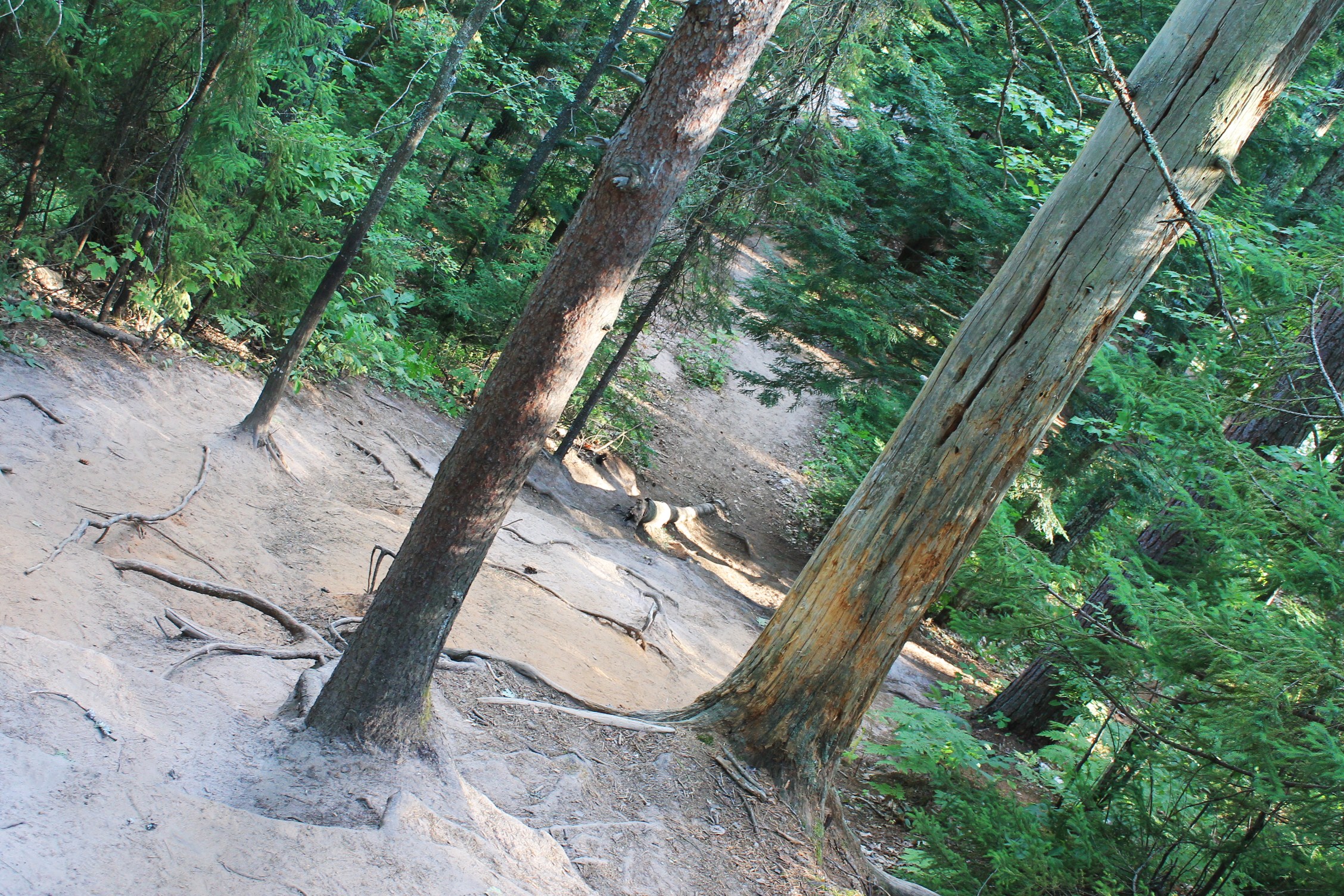
Once you get to the trail’s beginning, you have to walk up a steep, winding gravel service road which is tricky because of the loose stone. Once you get to the top, there is a set of wooden stairs on the left that is clearly marked.
 At the base of the stairs is a short level section, then a sandy, rooty drop-off. Be careful here.
 At the bottom is an open area with the Dead River on the left. There is a nice big rock to sit on, as well as a cascade to admire.
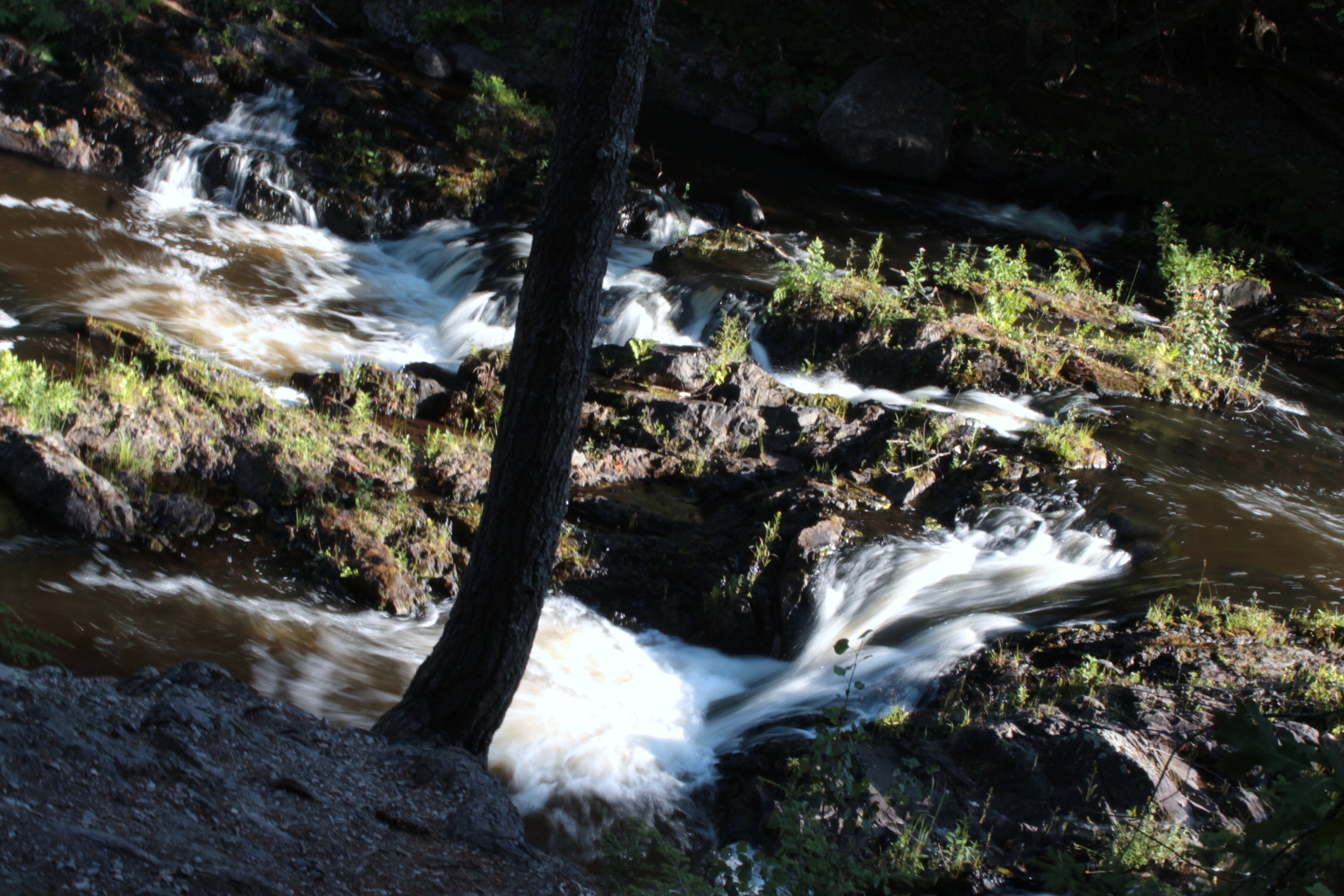 As you continue on the trail, you’ll come to a small creek which splits the trail, but there is a primitive log crossing. To your left you’ll notice the dark, jagged walls of a gorge that the locals call “The Barricade”. The falls are hidden behind this.
 The trail technically continues up a sandy embankment. Let me issue a word of caution here: If you have children, or if you are afraid of heights, or if you are not in good shape, don’t even attempt it. The reason is the hill is badly eroded and sandy, and footing is unstable. If you do scramble to the top of it, a sheer 20 ft. cliff awaits you on the left. This is where my wife and kids waited and sent me on to get pics. The trail hugged the cliff, and it seemed every step was a step away from sliding off the edge. It’s a mess.
 So, I climbed down to the river’s edge – which seemed the easier route. I rock-hopped up to The Barricade. The Barricade is a small, narrow canyon of sharp, jagged rock.
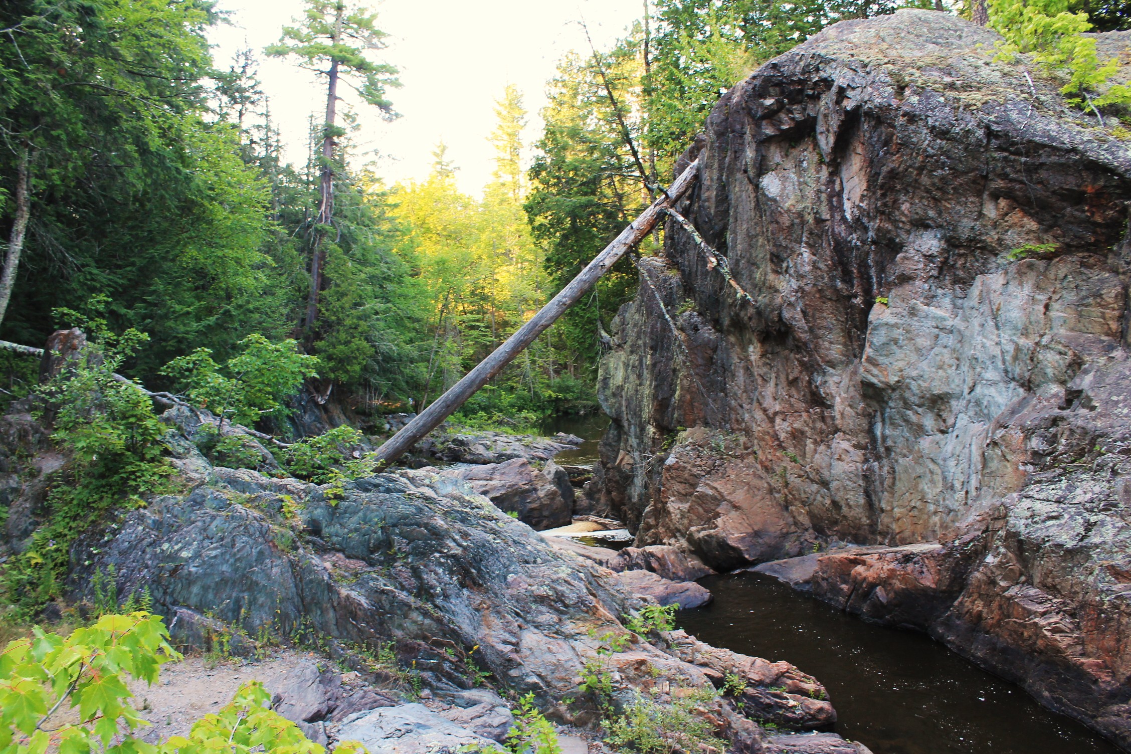 You’ll have to have sure footing here and some basic rock climbing skills.
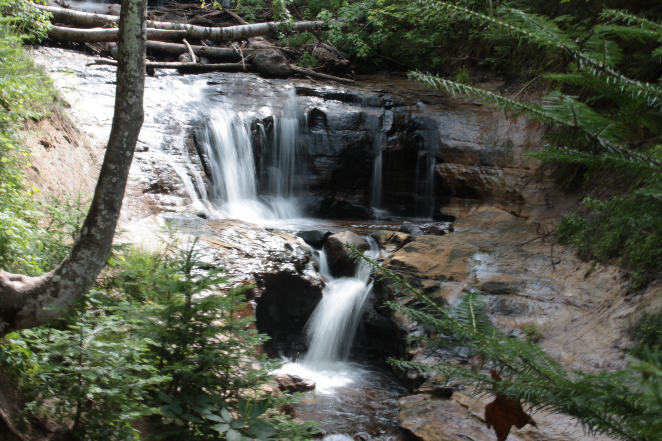
I made it to the top and the falls are on the other side. There are also a couple of cascades and sluices leading up to the main falls.
 After admiring the nice and roaring 15 ft. double falls for a little while and snapping some pics, I carefully climbed back down.
 Once down, I climbed out of the canyon, retrieved my family, and got them the heck back to solid ground!
This was a rewarding and strenuous hike to have been so short. The canyon section wasn’t very family-friendly, but for those who can, if you ever visit Marquette, Michigan, put Dead River Falls on your “must hike” list.


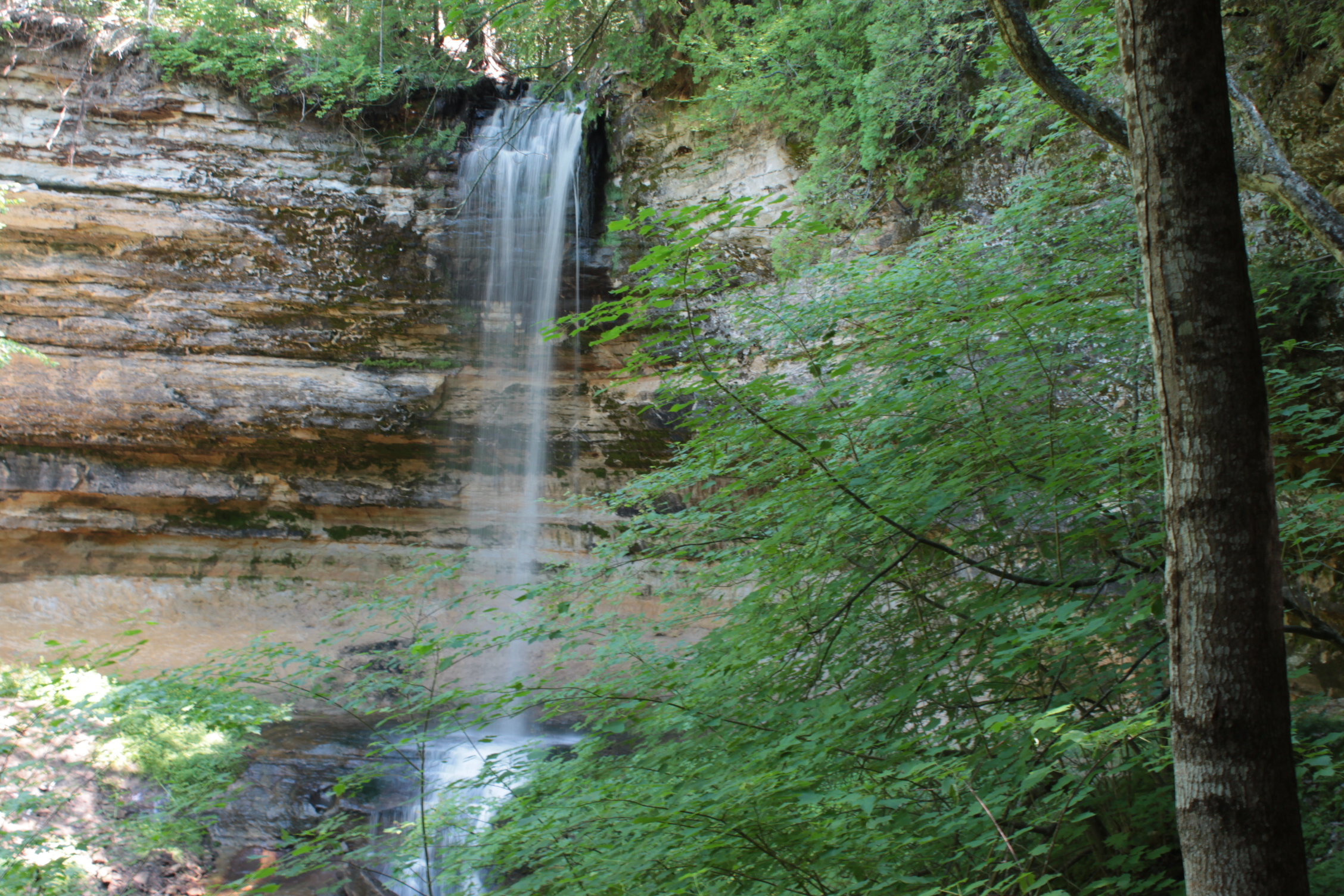
Sable Falls Trail
Sable Falls is a 75 ft. multi-level waterfall on Sable Creek that tumbles down into a canyon and empties into Lake Superior.
 The first section of the trail leads down 169 steps onto a viewing platform. Remember, if you have to go down the steps, you have to eventually go back up. 169 steps isn’t a cakewalk. Follow a sand covered boardwalk after the viewing platform.
 After exiting off the boardwalk, follow the sandy trail that winds through a deciduous and hardwood forest with Sable Creek to the left. We took our shoes off here and enjoyed the cool sand and the natural padding it provided.
 I estimate the trail is around 1 – 1.5 miles in length. Sable Falls Trail ends on a densely pebbled section of shoreline along Lake Superior. There were just a few people here, and the area was generally secluded.
 You can admire the high dunes on the left. There are warnings to stay off, as the dunes are extremely unstable and prone to landslides. The dunes are peppered with every size rock imaginable and climbing on them is an easy way to get hurt or killed. They, like waterfalls, are best admired from the base.
 This section of beach is a great place to rest, picnic, and look for agate and other stones. After we played here for a while, we hiked back up to the parking lot — barefoot, of course.
We also “hiked” (It was more of a stroll) up to see Munising Falls and the interesting cliffs around them, as well as a couple more lesser trails.
 In addition to the hiking, we were able to eat a local favorite pasty (pronounced “pass-tee”), tour the Pictured Rocks National Lakeshore, see a few of the Lake Superior shipwrecks, and swim in the beautiful (and chilly) waters of the Great Lake.
I really liked my first trip to the Upper Peninsula, Lake Superior, and the North Woods. It’s an area I wouldn’t mind returning to and hiking more of this area’s scenic and seemingly endless trails.


