

Synopsis
Alpine-type hike in the Black Mountains of North Carolina beginning at Mt. Mitchell to the 6,000’+ summits of Mt Craig and Big Tom.
Features
Alpine landscape, semi-technical trail, rock climbing, rare plants and fungi, breathtaking views.
Length
2.5 miles round-trip
Rating
Moderate – Strenuous
Description
The Deep Gap Trail is a classic Black Mountains hike that begins at the picnic area of Mt. Mitchell State Park and continues on to Deep Gap campground. Deep Gap boasts a stunning FOUR peaks that are above 6,000 ft., five if you include Mt. Mitchell. For our hike, we decided to include just the summits of Mt. Craig (6,663 ft.) – the second highest peak east of the Mississippi – and Big Tom (6,580 ft.), both of which are the first two peaks encountered on the trail.
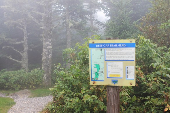
Deep Gap Trail is accessed at the Mt. Mitchell picnic area. Look for the giveaway trail head:
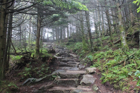
The first 1/4 mile or so of the trail is relatively level. Soon you’ll begin to start the first ascent down rock stairs that trail volunteers have kindly put in place.
As usual, the weather atop the Black Mountains is unpredictable. Below Mt. Mitchell the Blue Ridge Parkway was 73 degrees and sunny, but on the Deep Gap Trail, the air was chilly and fog was rolling in. Thunder clapped in the distance. Mountains this high are perpetually moist. These are two things to consider when hiking at heights such as this. Always carry proper weather gear (light jacket/poncho/rain jacket), and wear shoes with good traction. The Black Mountains are rocky and rooty – a slip or ankle twist is always a step away.
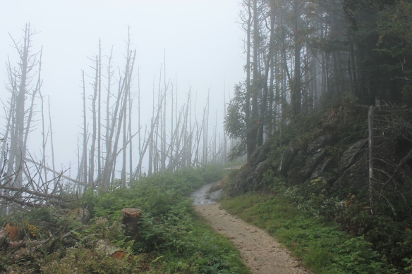
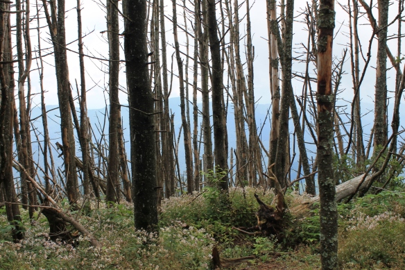
After making our way through the moss-covered forest, we came upon a cluster of dead evergreen trees, victims of the woolly adelgid, a non-native pest that feeds almost exclusively on the sap of evergreens. With the fog, the scene was quite surreal.
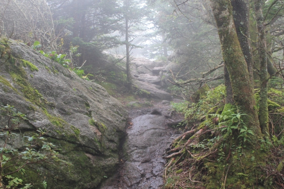
We wound our way in and out of dense, moss-covered alpine forest, catching a few views to the left. As the trail begins to ascend to Mt. Craig, there are several rocks and rock outcroppings that you’ll need to traverse. Most of them were ice slick with the moss and water. Be careful on these.
The trail then becomes fairly level as you continue along the ridge line
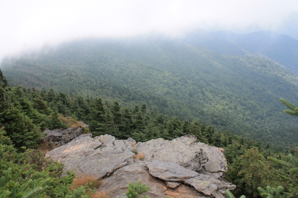
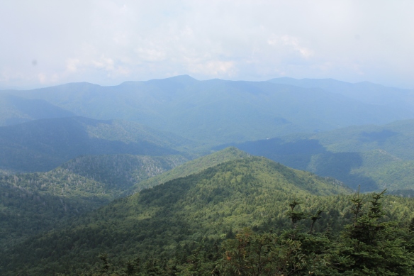
before ascending again to the first amazing overlook. The sun had broken through and the valley below was wide and green. This is a great place to rest, picnic, catch a cool breeze, or just soak in the beauty around you.

After resting here, continue up to the true summit of Mt. Craig, being careful to stay on the trail so as not to harm any of the rare alpine plant species.
There is a plaque around the corner as you head toward Big Tom, which commemorates North Carolina Governor Locke Craig, who played an important role in the establishment of Mt. Mitchell State Park.

From here continue on along the trail another 1/4 mile or so to the summit of Big Tom.
There is not much of a view here, but there is another plaque letting you know you’ve reached the summit:
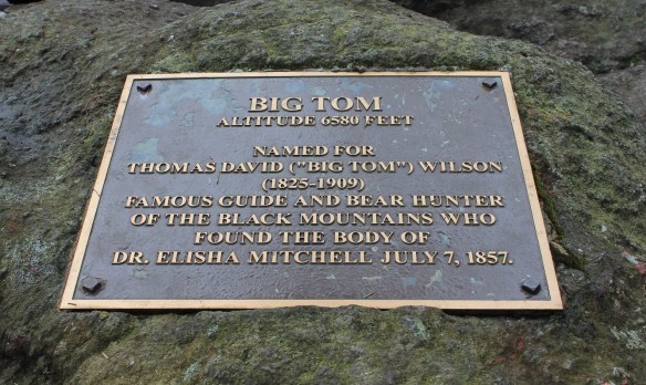
As you can read on the plaque, Big Tom was a colorful character who found and helped retrieve the body of Elisha Mitchell, for whom Mt. Mitchell is named, after he fell to his death during a geological survey.
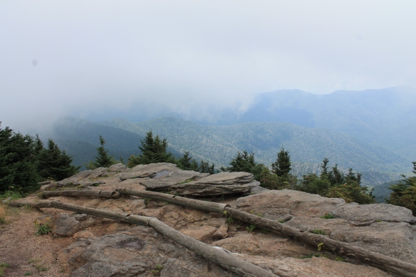
Here was the terminus for this hike. If you continue on the trail, you’ll summit Cattail Peak and Potato Hill, then ascend down into Deep Gap. To get back to the trail head, simply retrace your steps. If the weather is clear, you’ll find it hard to not stop and take in one more view of the valley below from the summit of Mt. Craig and if you’re lucky, Mt. Mitchell to the south.
See you on the trail!
